Drive along the Parkway.

brp1

It was a gorgeous day so I took the car up the Blue Ridge Parkway again.  I never get tired of its views.   This activity is so relaxing to me.

The first picture (above) I took at Craggy Gardens, which has an elevation well over 5000 feet.  The trees here are stunted, short, and knobby looking, due to both the cold and the wind.  A little higher up, and deciduous trees disappear completely and are replaced by a spruce/fir forest, similar to what you might see in Canada.  This is the home of the Frasier fir, similar to the kinds of trees you find in a northern boreal forest, but native to the southern Appalachians.  The Frasiers were almost killed off some years ago by the wooly adelgid, a parasite that attacks balsams, hemlocks, and fir trees, but they have grown back.  You can still see the white “skeletons” of the dead trees here.  Contrasted against the deep green of the live trees, they give the scenery an eerie feel.

The next four pictures are from Mt. Mitchell (the highest peak east of the Mississippi, just a little higher than Mt. Washington in New Hampshire), in the Black Mountains, the range of the Blue Ridge having the highest peaks.  The sign shows the elevation I was at when I took the picture.

There’s a road that branches off from the Parkway and continues to climb until you get to the parking area, which isn’t far from the summit.   It’s interesting to observe the changes in both microclimate and the ecosystem as you go higher.  It was a hot day, in the low 80s, but at the top of Mt. Mitchell, it was a frosty 55!  It was also interesting to me that the last deciduous trees, just before you reach the all conifer forest (taiga) were not merely stubby and short, but were also only just starting to turn green.  At this high an elevation, it looked (and felt!) more like March or early April than the end of May!   They probably aren’t even fully green until the end of next month, and of course winter comes here early too.  The trees here are green probably for only about 3 or 4 months or so, maybe from June until September.  Brrr!   I wonder how high a mountain would have to be this far South for the trees to disappear completely and be replaced with tundra.  Of course, there aren’t any mountains that high here.  I remember back in the 1980s, when I climbed Mt. Washington in New Hampshire with some friends.  Mt. Washington is almost the same height as Mt. Mitchell, but the last few hundred feet or so was a stark, grayish tundra.

The last three pictures are from farther up the Parkway, near Grandfather Mountain and Linville Gorge.   As you can see from the tree types, this is not as high an elevation, though it’s still pretty high.


Mount Mitchell State Park: 

brp2

brp3

brp5

brp4

Grandfather Mountain/Linville Gorge area: 

brpsix

brp7

brp8

I have to say, I think these are some of the best pictures I’ve taken of Blue Ridge Parkway scenery.


A beary good day.

lakelogan2

I took a drive out to Lake Logan, about 30 miles from here.  The lake’s surface was so still it was like a mirror.  There was no human activity at all (this is a very isolated lake, but in the summer there is still quite a bit of activity from people camping in the area).

lakelogan1

There’s a definite fall feel in the air even though the days are still hot and most of the leaves haven’t really begun to turn yet.   Summer is definitely over.

Driving back home along some back roads, was I in for a surprise!    This black bear was standing in the middle of the road and at one point was quite close, but he quickly lumbered off before I could grab my phone to get a closeup picture.   I managed to snap this photo before he disappeared back into the woods.  I guess he found the attention unbearable.

bear


Sunday drive to Mount Mitchell.

mtmitchell1

I had to get out of the house yesterday and clear my head.  I’ve been very upset about the situation with the children at the border.

Nature usually calms my soul and centers me, so in spite of the iffy, partly cloudy weather, I took a drive to Mount Mitchell State Park, about 50 miles to the north from where I live.   Mount Mitchell is part of the Black Mountains (eastern flank of the Blue Ridge) and at 6,683 ft is the highest mountain on the East Coast (Mount Washington in New Hampshire is the second highest, at 6,289 ft).

mtmitchell7

It was noticeably cooler at the summit, almost sweater weather.  That high up, only conifer trees can grow, and the area is known for its Frasier firs, a species known only to this area that almost died out about twenty years ago due to an aphid infestation.  There are still many white skeleton-looking trunks of the trees that died off, mixed with the newer trees, giving the area an eerie but interesting look.

I took these photos.  Hope you like them.

mtmitchell2

mtmitchell3

mtmitchell4

mtmitchell5

mtmitchell8

mtmitchelltree

mtmitchell9jpg


A fun day.

100yrold2

Side view of the Hundred Year Old Cabin, Arden, NC.

Yesterday was my daughter’s birthday, but this year has gone by so fast (and because of the continued cold weather, I was having trouble believing spring had really arrived), so I almost forgot about her birthday. It just sort of snuck up on me.   So I realized yesterday I hadn’t made any plans or gotten her anything.

I stopped by a cupcake shop on the way home and got six different types of cupcakes, then had her pick her favorite one (red velvet cake).  Then I placed a candle on top of it and brought it out to her while we sang happy birthday (I did not get a picture of that but I should have — the cupcakes were adorable and so colorful).

Then I told her I wanted to go for a drive and wanted company.   What I had in mind was a 3 mile trip to some river cabins I’d always been curious to see.     She and her boyfriend joined me, thinking the trip would be boring, but it wasn’t at all!

There are seven adorable rental cabins tucked away in the woods by the river.   Six of them are new, and all perfectly charming (we could actually go inside two of them), but the one that fascinated me the most was the Hundred Year Old Cabin.   We didn’t get to see the inside of it, but it’s very photogenic, as you can see below.

100yrold1

Back view of the Hundred Year Old Cabin

100yrold3

Front view of the Hundred Year Old Cabin

rivercabin2

rivercabin1

Two photos of one of the newer river cabins.

We got to try out the hammock on one of the cabins closest to the river.   It was a beautiful day, and so relaxing just swinging in it and hearing all the nature sounds.  It was hard to believe I wasn’t on vacation and only a few miles from my home .

hammock1

We walked around the campgrounds for a while and took some pictures of the river, then we headed to Panera Bread for her birthday dinner.

river1

river2


Asheville Womens March 2018!

ashevillewomensmarch


I wasn’t able to attend the Womens March that took place in downtown Asheville today, but the day was beautiful (sunny, high 50’s) and the turnout was unbelievable!  My jaw dropped to the floor when I saw this photo (which I was informed later is actually from 2017, but the turnout was the same or even greater than last year’s).

Asheville is a very progressive (deep, deep indigo blue!) bastion in a mostly red state (though a lot of the “redness” is misleading, since the GOP gerrymandering here is the worst in the nation.  There are actually quite a few blue/Democratic areas in North Carolina, particularly in the urban areas.

But I’m fortunate to live in what is probably the most politically progressive city in the state, outside of the Raleigh/Durham/Chapel Hill area, which is full of colleges and universities.   Asheville has a couple of colleges, but higher education isn’t its main draw.  We’re a haven for artists, musicians, people involved in the healing arts, and other creative types, and people from other areas of the country seeking the vibrant culture here as well as the beautiful scenery and the weather — we have all 4 seasons, but the winters are generally milder than what you find farther north and the summers are not that hot because of our location in the mountains.

The turnout in this small city (population about 89,000) was incredible.   It might as well have been in a big city like New York or Chicago!

Beautiful weather, beautiful city, beautiful people.   I’m proud to live in Asheville even though I wasn’t able to attend the march today.    I’m thrilled that the resistance seems to be growing even after a year of Trump, and proud of my fellow Ashevillians.

The longest, hottest, most boring drive ever.

Note: Photos were not taken by me.  I found them on Google Image.  

i40

There are many dangers in driving, but one no one ever talks about is the danger of the long, boring drive.   If anything can put you to sleep, it’s the never-changing, flat as a board, monotonous landscape of Eastern North Carolina along US Route 40.     It’s dangerous because the utter lack of any features of interest can make you fall asleep.

I enjoy driving.  It relaxes me.  Sometimes I just get tired of sitting around the house.  I’m regularly afflicted with attacks of wanderlust.   Sometimes I drive places — sometimes far away — not as a means to an end, but for the sheer joy of just driving.  Sometimes I drive to faraway places just to be able to say I drove there, without having a plan once I get there.

I’ve lived in western North Carolina for 23 years but I have never driven across to the east coast and on a whim, I decided to do just that yesterday morning.    Never mind that the drive there and back totals almost 700 miles.  That’s farther than driving to my son’s place in Florida!  Never mind that the weather forecast yesterday called for afternoon thunderstorms and it was a sweltering 90 degrees out at 9 AM.  Never mind the fact that I had no plan and there would be no time to enjoy the beach even if that was my goal   since, because I can’t see well at night, I’d have to turn right back around when I got there and head back.    No, I just wanted to get out of the house and go somewhere I’d never been before.  I’ve never driven clear across my state and decided it was time to check that off my bucket list.

I didn’t expect it to be the most exciting drive ever — remember, I do these drives to relax —  but I wasn’t prepared for just how mind numbingly dull the ride would actually be.   If you’ve ever driven across South Carolina (which I have), it’s like that, only without the palmetto trees and about four times as long (or at least it seems that way).  Also, along I-26 (the route I take to drive through that state), South Carolina’s dull, flat terrain at least is peppered with interesting sights like ramshackle fireworks stands along the roadsides that are open all year long, ancient and abandoned I-houses sitting all alone in fields of tall weeds, sad trailer parks, and Confederate flags waving gaily in the hot breeze.

You also can’t get too bored in South Carolina because I-26 is scary as hell.   Everyone seems to speed on it — the so-called slow pace of the South does not apply on South Carolina highways — and by speeding I mean roaring along at 100 mph when the speed limit is only 65.   The lanes are too narrow and semis and 18-wheelers are all around you, sometimes with only two inches to spare on the passenger side.   It’s common to be completely boxed in by semi-trucks, with a deep ditch on your left as your only escape should one of the truckers decide to switch into your lane suddenly without signaling (another thing drivers seem to do a lot of there).    If you’re in one of the urban centers of Columbia, Greenville or Spartanburg when that happens,  all you can do is pray since there isn’t even a ditch in some places, but a concrete wall.

And there are lots of cops there too.  Cops who allow the speeders to keep on going if they have South Carolina tags, but will pull you over for doing 70 if they see you’re from out of state.  They consider people from North Carolina to be Yankees and apparently hate us.  I know, because I got pulled over in that state twice.  And I’m not speeding type.   In fact, I’m much more the hesitant type that other drivers get mad at for going below the speed limit.  Both times I told the officer I was just trying to keep up with traffic (I was still going slower than almost everyone else), but he wasn’t buying it and still ticketed me.  The first time it happened I had to drive all the way to Travelers Rest to appear in court (this was in the ’90s).  The other time I was allowed to pay by mail.

So my point is, in South Carolina, you can’t nod off from boredom while driving.   Nervous, angry,  hyper-alert, or downright terrified, but I guarantee you won’t fall asleep at the wheel.

iredellcounty

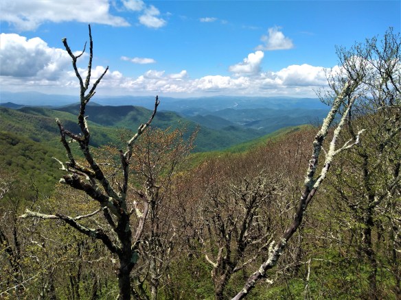
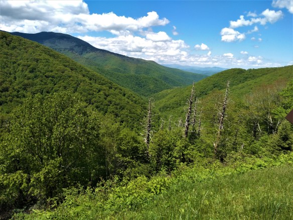
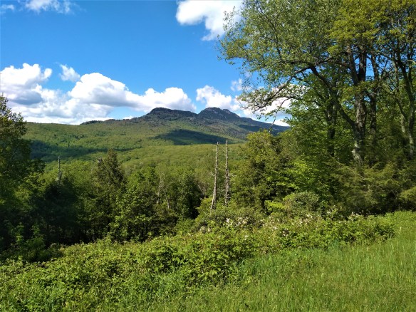
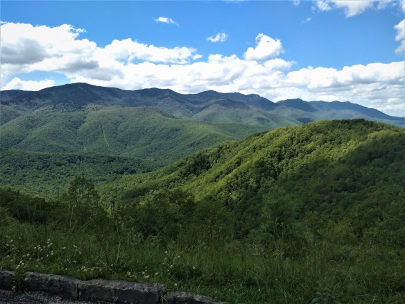
There’s none of that nail-gnawing, white-knuckling, tooth-grinding business along I-40 in North Carolina, at least not east of Raleigh.   Sure, of course, for those not used the the mountains of the western end of the state, the many hairpin curves and steep grades there can cause a lot of gnashing of teeth, cursing, and white-knuckled steering-wheel gripping.  And I do understand about those annoying and sudden telescoping lane changes and merges in the urban areas and during rush hour that can jangle anyone’s nerves, but on a weekend it’s not so bad.  My GPS tells me when these lane changes are coming up, so it’s not really a nuisance or an issue for me.  And once you finally navigate the hundred-plus mile stretch of asphalted urban sprawl with its bloated 6-to-8-lane interstates and all its feeder highways and roads that stretch from Statesville just east of the mountains and the Triad of Winston-Salem/High Point/Greensboro in the Peidmont all the way to the Tri-Cities of Chapel Hill (a charming college town), Raleigh and Durham (still part of the Peidmont), you can rest fairly easy that losing your life on the road is pretty remote (unless you nod off).

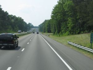
Once you pass the massive urban sprawl in the center of the state, which is pretty boring itself (not to mention ugly), you emerge into the Atlantic Coastal Plain, an area that sounds like it could be peaceful and pretty, and to be fair, it is that.   But its prettiness is marred by its devastating sameness.   A long stretch of flat two-lane highway flanked on both sides by endless short pine trees, all of the same size and width, interspersed only occasionally by the odd water tower and farmland as flat as a table, not even broken up by tacky billboards or other jarring sights, can send you into a hypnotic trance.   The various towns are well-hidden along this stretch of I-40, so you don’t even see any tall signs advertising gas stations or fast food places.   It goes on like this for at least a hundred miles, before the landscape changes to a somewhat more coastal-looking one, with even scrubbier, shorter trees and grasslands — but oddly, no visible water.

Granted, the landscape of eastern North Carolina isn’t as  jaw droppingly ugly as the New Jersey Turnpike or as delightfully tacky as US-Route 19 that runs roughly parallel to the west coast of the Florida Gulf,  but at least those things add some interest to the landscape in a kitschy, schadenfreude-ish, thank-God-I-don’t-live here sort of way.   The landscape along I-40 east of the Blue Ridge and the vast urban metropolis that marks the state’s central region lacks any memorable features at all, and all that sameness gives way only to the sad, stunted trees and swampy grasslands of the coastal plain.

ncflatlands

As I drew within 35 miles of the coast, I still didn’t see any evidence of the ocean other than sandy-looking soil along the side of the road and sometimes blowing onto it.     I kept driving, looking for telltale inlets, rivers, or boats, or something indicating the presence of the nearby Atlantic, but nope, nothing.   The stunted trees and sandy soil just got more stunted and sandier, and the land remained as dry as the Sahara.     I kept driving.   25 miles, 20 miles, 15 miles from the coast, but still no water.    Yet I knew I was near the ocean because I began to see fishing tackle places and beach shops here and there.  Here, the lack of trees failed to hide any commercialism lurking behind the exits, and it was hot.  Hellishly hot.

I drove into a gas station and got out of the car to stretch my stiff legs, get a drink and a candy bar, use the bathroom, and fill my tank, and I felt like I was inside a pizza oven. Where was the sea breeze?  There wasn’t any.    The heat was oppressive, sweltering, almost painful.  My brain wasn’t working correctly.  My thoughts limped along like 90-year old men.    I finished my business and got back in the car, immediately blasting the air conditioning.  I noticed the sky was beginning to cloud up pretty badly  and I remembered the forecast about thunderstorms.   I don’t like driving in thunderstorms, and it was also getting pretty late, so I decided right then and there to turn around and head back home — all 350 miles of long, boring drive.   I groaned at the thought of that but what other choice did I have?

The ride home was slightly more interesting.   I got to watch the development of two storms ahead and to the south of me.  I watched the towering cumulonimbus clouds spread out and turn grey-black.   Lightning flashed in the near-distance.   I would have taken pictures except for the fact I was driving.    Fortunately, neither storm hit directly, and the drive back was marred only by a a little rain, not a downpour or a hailstorm.   The storms also cooled things off, and I was finally able to turn off the air and open the windows to let in some fresh air.

I finally passed the storms, and saw nothing but blue sky and the golden light of the late afternoon sun ahead of me.   In my rearview mirror, I saw the most gorgeous rainbow I’ve ever seen.  I wanted to pull over and get a picture of that too, but unfortunately such a thing wasn’t possible in the middle of the interstate.    But I felt like my drive had been worth it, even though I’d never actually made it to the coast.    I took the rainbow behind me and the coppery rain-drenched sunshine ahead of me as validations that my decision to drive hundreds of miles to nowhere in particular for no particular reason had been the correct one.  Besides, people who have driven across the Great Plains tell me that’s even more boring — and there you get tornadoes too.

****

Further reading:

8 Ways to Survive a 637-Mile Car Trip — and Make it Amazing 

15 Things I Love and Hate About Long Road Trips

Driving Before Dawn on a Sunday Morning

Memorial Day Photos — Blue Ridge Parkway, NC (Balsams, Plott Balsams, Devils Courthouse)

I had no plans for Memorial Day and no one to spend it with, and I was going stir crazy sitting around the house, with nothing to do but watch the depressing news.     So I decided to go for a drive.

I’m lucky to live very close to the Blue Ridge Parkway, so I decided to drive south along it into the Plott Balsams, about 50 miles from my house.  This range (which is east of the Smokies) contains the highest peak along the parkway (6,053 feet).    The highest peak on the East Coast is Mount Mitchell (6,674 feet) in the Black Mountains, but that’s about 50 miles in the other direction.

I moved to western North Carolina in 1993, and I remember these high peaks you see pictured here used to be almost bald and covered with the dead white remains of the Frasier firs, which were almost made extinct by an aphid infestation that killed almost all the trees at this elevation.   Now they are lush and green again, but in a few of the photos, you can still see the white trunks of the dead trees peeking through the green.  I love the contrast of the dark green of the firs and balsams against the light green of the deciduous trees (which stop growing above 4,500 – 5,000 feet).   The pink flowered shrubs are wild rhododendron.

Enjoy the photos I took today.

52917_1

52917_2

52917_3

52917_4

52917_5

52917_6

52917_7

52917_8

52917_9

52917_10

52917_11

52917_12

52917_13

52917_14

52917_15

Autumn’s last gasp: day trip on the Parkway.

brp_1105_2

Looking up toward Craggy Dome, 6105 ft.

Down here in the southern Appalachians, the trees still have some color (a few are even still mostly green!)  I’m also happy to say that once October came, the trees seemed to be more colorful than they have been in the past several years.   Perhaps this was due to the very rainy July and August, followed by a very dry September.   It’s also been unseasonably warm (though not hot).  So I actually found myself appreciating Fall more this year.

This is my second drive along the Blue Ridge Parkway since fall started, and I’m happy to say the weather this time was much more pleasant than the last time.   This time I decided to drive north on the Parkway (last time we drove south, to Mount Pisgah),  with the intention of making it to the Virginia border.

But I got a very late start (it was almost 1:00 when I started out) and drove as far as I could to leave myself enough time to drive back before it got too dark.   I made it as far as the Blowing Rock/Boone area , which is about 120 miles north from where I live.

brp_1105_6

The parkway begins to climb when you enter the Black Mountains, on its way to Mount Mitchell, the highest peak on the East Coast.   I chewed gum to relieve the popping in my ears.  As you climb, the trees become shorter and scrubbier, almost like shrubs.  At that high an elevation, that’s as high as deciduous trees can grow.  Their short and slightly twisted stature helps them conserve energy and protects them from the high winds.  At that high elevation, the air is colder and the trees were completely winter-bare–except that many of these trees are sporting clusters of bright red  berries!    Craggy Gardens, several miles south of Mount Mitchell, is filled with wild evergreen rhododendrons and all those attractive red-berried small trees.

brp_1105

brp_1105_1

I had the radio on while I drove, and kept switching stations.   I settled on a country station that was playing this song about driving on backroads so I left it on and sang along while driving.

As you drive farther, you can see the rather sharp delineation (around 5,500 feet) where the conifers and fir trees (taiga zone) begin to take over from the last stunted deciduous trees.   That high up, the climate is too cold for even deciduous trees to survive.   At the tops of the peaks of the Black Mountain range, there are nothing but dark conifers, which gives the mountains the black appearance that inspired their name.    The starkness of the landscape this time of year gives it a primordial feel and you are stuck by just how ancient these mountains are (they are the oldest mountain range in the world: millions of years ago, they were as high as the Sierras).

brp_1105_4

Once you pass through the Blacks, the road descends and your ears start to  pop again.  For about 30 miles the landscape is pretty, but not that exciting.  There are a few spectacular views from the various outlooks, where people stop to take pictures or take a break from driving.   The deciduous trees took over again, but this far north, I noticed they were almost completely bare and did not show the color the trees farther south did.    I realized that even though I’d only driven about 70 or 80 miles by this point, I’d probably entered a more northerly “hardiness” zone.   The landscape had a decidedly more “northern” look even though I was still in North Carolina (and would be for some time, since I live very close to the South Carolina border).

brp_1105_5

I drove about another 50 miles and passed through another mountain range almost as high and impressive as the Blacks with a more rugged appearance (Linville Gorge Wilderness).  Grandfather Mountain is here,  just outside of Marion, and I remembered my son went on an Outward Bound expedition here as his 8th grade school trip and how much that experience seemed to change and mature him.   By this point I was picking up a rock station out of Winston-Salem, so I left that on for awhile.   I also found another station–an oldies station that plays only music from the 50s and 60s!  (I didn’t think those existed anymore!)

brp_1105_7

I kept driving, and the landscape leveled out again.   I passed through areas where you could actually see private homes and farms from off the Parkway (closer to where I live, the Parkway’s surrounded by the Pisgah National Forest, so you cannot see private homes or property from the road).   It looked like winter here, even though the temperature wasn’t that cold.   When I reached the Blowing Rock/Boone area, I decided it was time to turn around and go back.  It was already close to 3:30 and since I have such terrible night vision and knew it would be getting dark by 6 (we set the clocks back tonight, folks) that I could go no further.   My bladder was about to burst!  I stopped back at Craggy Gardens to pee, but had to use their Port-a-Potty because the visitor center was closed.

brp_1105_8

I arrived home just after sunset.   I love driving on the Parkway; it’s always so relaxing and spiritually uplifting, no matter what time of year I go.

The Apple Festival, Hendersonville, NC

applefestival3

My daughter and her new beau Zach (a really sweet 22 year old guy who is showing NO red flags so far) told me they were going to the annual Apple Festival in downtown Hendersonville, North Carolina, which is only a few exits south of me on I-26.   They asked me if I wanted to come.  I had some chores to do, but I said I’d join them later on.

applefestival1

applefestival2

Henderson County is one of the biggest apple producers in the country, and the Apple Festival is basically a big street fair where the apple growers come to sell their harvests of apples.  Just about every variety of apple is available, sold out of makeshift stands.  There are also food stands, arts and crafts, a few rides, and a concert in which local musicians perform that’s held at night (I didn’t stay for that). It’s pure Americana.

applefestival4

Downtown Hendersonville has a lot of cute mom and pop stores and small art galleries, and on every corner are bears — not real bears, but full size bear sculptures painted in creative ways, most with landscapes or other decorations painted on them.

applefestival5

applefestival7

The last time I’ve been to the Apple Festival was in 1995, when my kids were just toddlers.  For many years, it was eclipsed by Bele Chere, a huge street fair which was held every summer in downtown Asheville from 1979 to 2014.  Now the Apple Festival is THE street fair in this region.

applefestival6

We had a lot of fun.  I didn’t have a lot of money to spend (most of it being spent in Florida last week), but we walked around and looked at the local arts and crafts, and I stopped for an apple slushie and all three of us shared a funnel cake (which was so filling it turned out to be my dinner).  You can’t go to a fair and not have funnel cake!  And of course, I bought a bag of apples to take home.

applefestival8 applefestival9
“How to Be a Gentleman” and “How to Be a Young Lady” — mandatory reading for Millennials?

applefestival10 applefestival11

I don’t like to drive after dark because I have such terrible night vision, so I left just before sunset, while the kids decided to stay longer and then go out to a movie.  On the way home, I saw the most incredible sunset (which rivaled any I saw over the Gulf of Mexico last week), unobscured by trees or mountains.  I grabbed my camera and took a picture of it while driving back home on I-26 (I DO NOT recommend doing this!)

applefestival12

Clearing my head.

brp1

I needed to clear my head today.  Sitting around the house does me no good at all and it’s easy to sink into negative emotions like depression and worry.    I knew I had to get out for awhile.  Fortunately I live very close to the Blue Ridge Parkway, so I decided to take a nice long Sunday drive.   I decided to go up into the Black Mountains, part of the Blue Ridge just north and east of Asheville.

brp4

I drove about 60 miles, to Green Knob, which is about 15 miles past Mt. Mitchell (at 6,683 feet, it is the highest peak on the East Coast, even higher than Mt. Washington in New Hampshire).  I was going to go up to Mt. Mitchell and take some pictures, but I took one look at the line of traffic on the off road going up there and said, “no way.”   There are other spots just as nice.

brp2

brp3

The drive up there is always interesting.   As you climb, you feel your ears pop, and the air gets noticeably cooler.   I was able to turn off my A/C and roll down the windows and breathe in the fresh mountain air.    After awhile, the deciduous trees get shorter and stumpier, until they are mere twisted shrubs.   Craggy Gardens is filled with these stunted little trees and lots of wild rhododendrons, which are native to this area.   When they’re in full bloom, they have beautiful, big lavender clusters of flowers.   Right now they’re just dark green.

brp5

Climb a little higher, and the deciduous trees and shrubs are completely replaced by conifers.    I’ve been told the climate up here is similar to southern Canada.   There’s a lot of ice and snow here in the winter and this part of the Parkway is usually closed off during the cold months.   Mt. Mitchell itself is covered with the skeletons of the Frasier firs, which were indigenous to this area but died off about 30 years ago due to an aphid infestation. But it isn’t all bare–there are other types of conifers that are surviving quite nicely.

brp6 brp7

On the drive home, it rained a little–some of the photos here show the building up of the storm clouds.   I got home and felt much more at peace.  Spending time with nature always has that affect on me.   Here are the rest of the photos I took today.

brp8

brp10

brp11

brp12

brp13

brp16

brp17