Drive along the Parkway.

brp1

It was a gorgeous day so I took the car up the Blue Ridge Parkway again.  I never get tired of its views.   This activity is so relaxing to me.

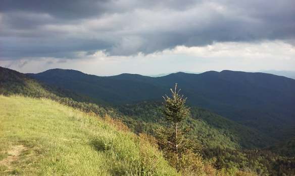
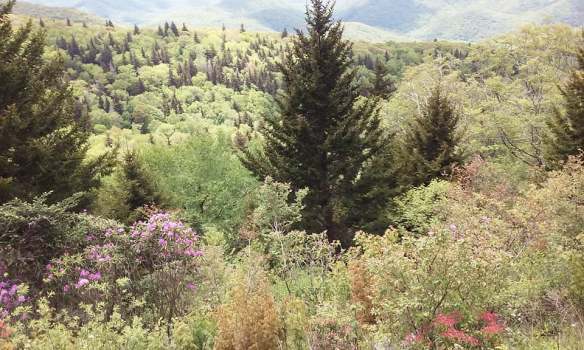
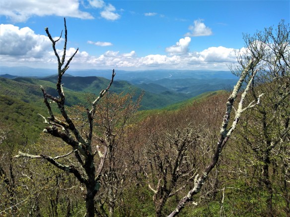
The first picture (above) I took at Craggy Gardens, which has an elevation well over 5000 feet.  The trees here are stunted, short, and knobby looking, due to both the cold and the wind.  A little higher up, and deciduous trees disappear completely and are replaced by a spruce/fir forest, similar to what you might see in Canada.  This is the home of the Frasier fir, similar to the kinds of trees you find in a northern boreal forest, but native to the southern Appalachians.  The Frasiers were almost killed off some years ago by the wooly adelgid, a parasite that attacks balsams, hemlocks, and fir trees, but they have grown back.  You can still see the white “skeletons” of the dead trees here.  Contrasted against the deep green of the live trees, they give the scenery an eerie feel.

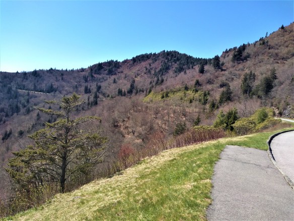
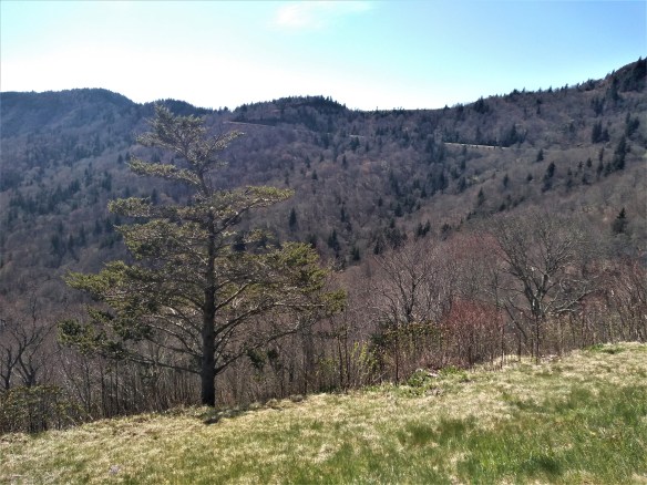
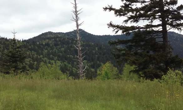
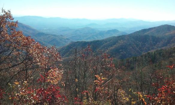
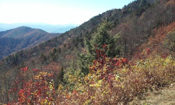
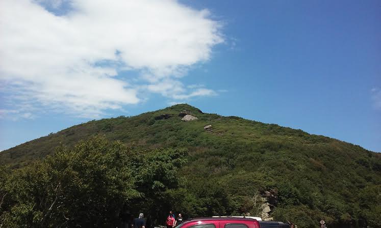
The next four pictures are from Mt. Mitchell (the highest peak east of the Mississippi, just a little higher than Mt. Washington in New Hampshire), in the Black Mountains, the range of the Blue Ridge having the highest peaks.  The sign shows the elevation I was at when I took the picture.

There’s a road that branches off from the Parkway and continues to climb until you get to the parking area, which isn’t far from the summit.   It’s interesting to observe the changes in both microclimate and the ecosystem as you go higher.  It was a hot day, in the low 80s, but at the top of Mt. Mitchell, it was a frosty 55!  It was also interesting to me that the last deciduous trees, just before you reach the all conifer forest (taiga) were not merely stubby and short, but were also only just starting to turn green.  At this high an elevation, it looked (and felt!) more like March or early April than the end of May!   They probably aren’t even fully green until the end of next month, and of course winter comes here early too.  The trees here are green probably for only about 3 or 4 months or so, maybe from June until September.  Brrr!   I wonder how high a mountain would have to be this far South for the trees to disappear completely and be replaced with tundra.  Of course, there aren’t any mountains that high here.  I remember back in the 1980s, when I climbed Mt. Washington in New Hampshire with some friends.  Mt. Washington is almost the same height as Mt. Mitchell, but the last few hundred feet or so was a stark, grayish tundra.

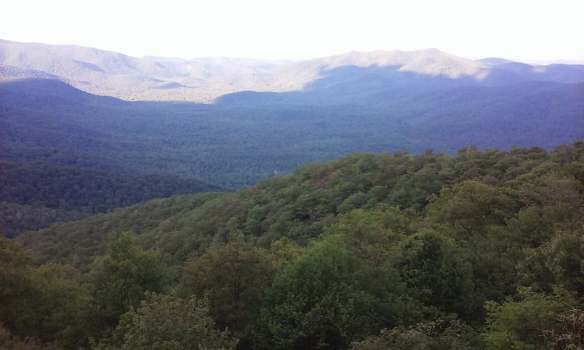
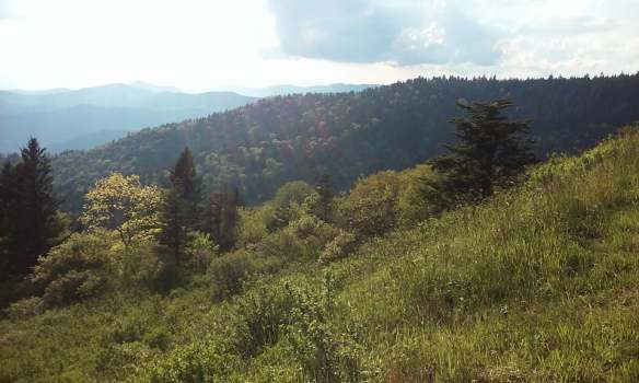
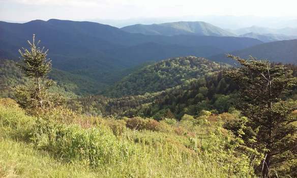
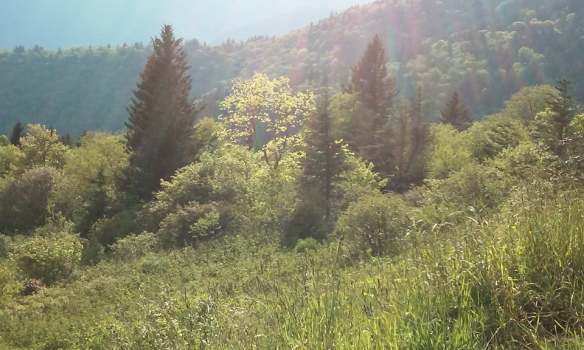
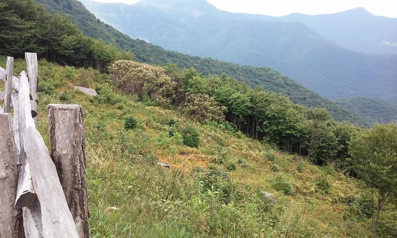
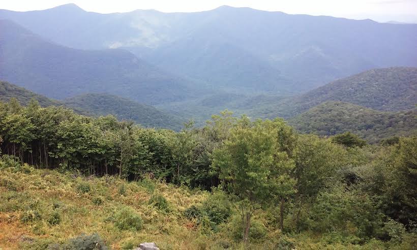
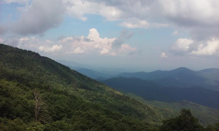
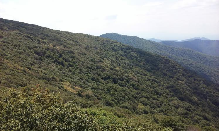
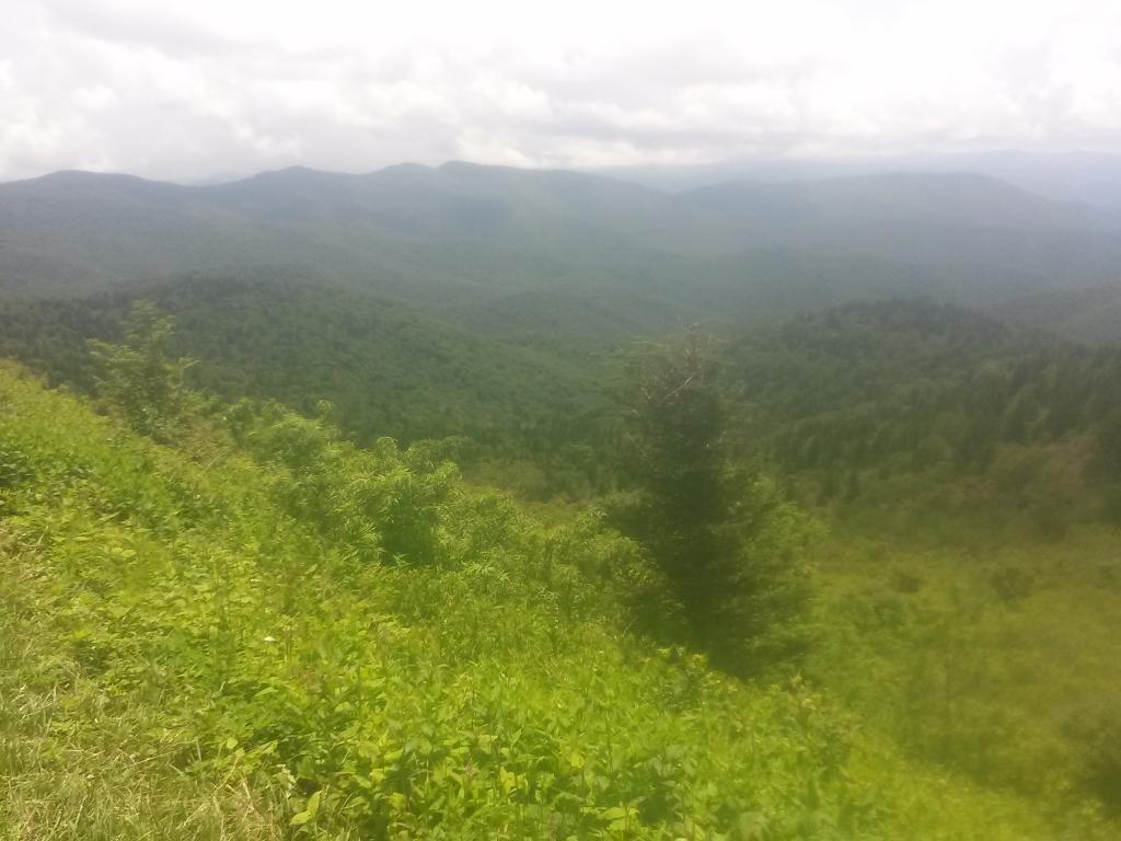
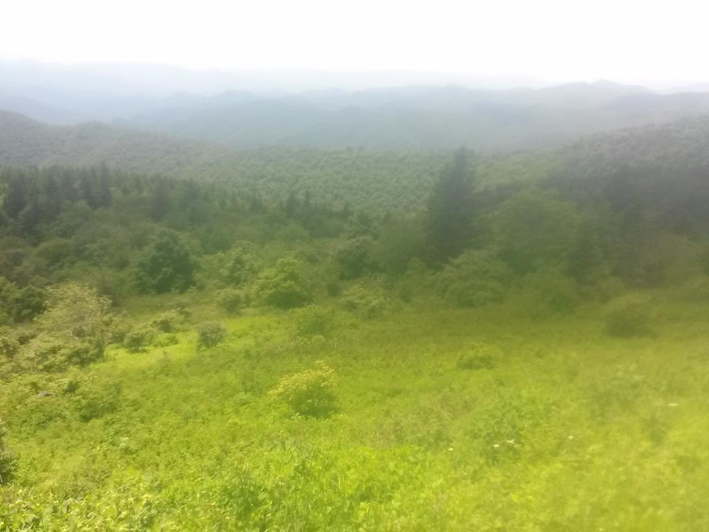
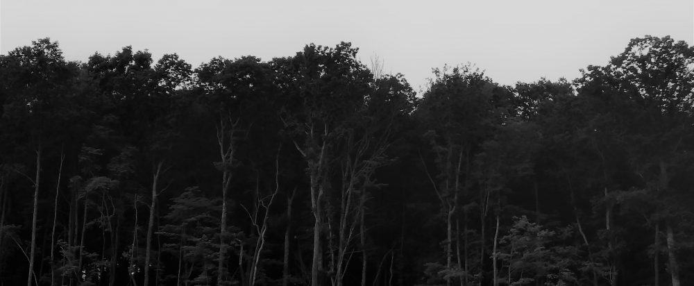
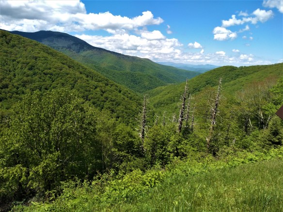
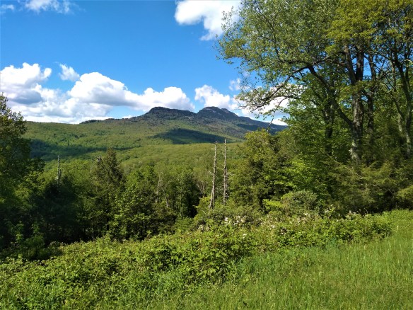
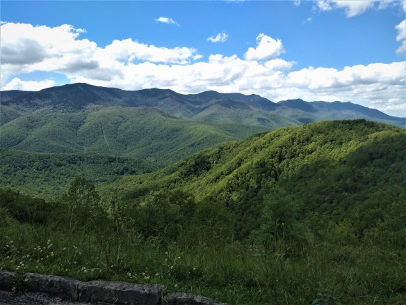
The last three pictures are from farther up the Parkway, near Grandfather Mountain and Linville Gorge.   As you can see from the tree types, this is not as high an elevation, though it’s still pretty high.


Mount Mitchell State Park: 

brp2

brp3

brp5

brp4

Grandfather Mountain/Linville Gorge area: 

brpsix

brp7

brp8

I have to say, I think these are some of the best pictures I’ve taken of Blue Ridge Parkway scenery.


Drive along the Blue Ridge Parkway, 4/14/20

blueridge1

I wanted to kill some time, and the day was too pretty to stay cooped up indoors.  So I took the car out for a spin.

I took these photos from the highest part of the Blue Ridge Parkway, in Jackson County, near Sylva.   It still looked like winter up this high (around 5500 – 6,000 ft).  Most of the trees are still bare, though a few are starting to bud.  A little higher up, and deciduous trees give way completely to Fraser firs (a type of conifer native to the Southern Appalachians that grows on the highest slopes).

The microclimate at these heights has been compared to that of states much farther north, and even southern Canada.  It never gets very hot here, even in the summer, and it gets a lot more snowfall than we do in the valleys and lower elevations.  I don’t think anyone actually lives this high up, though.

blueridge

blueridge2

blueridge3.jog

blueridge4


Friday evening drive into the mountains.

060217_2

I was bored and needed to clear my head, so I headed into the mountains again.  I took the same route I took on Memorial Day.   It was later in the day though, so there was this wonderful late afternoon golden light that was just magical.

There was no one at the overlook where I stopped to take photos, and no signs of civilization at all, not even any cars on the road.  I felt like the only person in the world, and realized these mountains looked exactly this way thousands of years ago.   This is what the native Americans would have seen, long before there were any paved roads.

060217_1

060317_3

060217_3

060217_4

060217_5

060217_6

060217_8

060217_9

060217_10

Memorial Day Photos — Blue Ridge Parkway, NC (Balsams, Plott Balsams, Devils Courthouse)

I had no plans for Memorial Day and no one to spend it with, and I was going stir crazy sitting around the house, with nothing to do but watch the depressing news.     So I decided to go for a drive.

I’m lucky to live very close to the Blue Ridge Parkway, so I decided to drive south along it into the Plott Balsams, about 50 miles from my house.  This range (which is east of the Smokies) contains the highest peak along the parkway (6,053 feet).    The highest peak on the East Coast is Mount Mitchell (6,674 feet) in the Black Mountains, but that’s about 50 miles in the other direction.

I moved to western North Carolina in 1993, and I remember these high peaks you see pictured here used to be almost bald and covered with the dead white remains of the Frasier firs, which were almost made extinct by an aphid infestation that killed almost all the trees at this elevation.   Now they are lush and green again, but in a few of the photos, you can still see the white trunks of the dead trees peeking through the green.  I love the contrast of the dark green of the firs and balsams against the light green of the deciduous trees (which stop growing above 4,500 – 5,000 feet).   The pink flowered shrubs are wild rhododendron.

Enjoy the photos I took today.

52917_1

52917_2

52917_3

52917_4

52917_5

52917_6

52917_7

52917_8

52917_9

52917_10

52917_11

52917_12

52917_13

52917_14

52917_15

Autumn’s last gasp: day trip on the Parkway.

brp_1105_2

Looking up toward Craggy Dome, 6105 ft.

Down here in the southern Appalachians, the trees still have some color (a few are even still mostly green!)  I’m also happy to say that once October came, the trees seemed to be more colorful than they have been in the past several years.   Perhaps this was due to the very rainy July and August, followed by a very dry September.   It’s also been unseasonably warm (though not hot).  So I actually found myself appreciating Fall more this year.

This is my second drive along the Blue Ridge Parkway since fall started, and I’m happy to say the weather this time was much more pleasant than the last time.   This time I decided to drive north on the Parkway (last time we drove south, to Mount Pisgah),  with the intention of making it to the Virginia border.

But I got a very late start (it was almost 1:00 when I started out) and drove as far as I could to leave myself enough time to drive back before it got too dark.   I made it as far as the Blowing Rock/Boone area , which is about 120 miles north from where I live.

brp_1105_6

The parkway begins to climb when you enter the Black Mountains, on its way to Mount Mitchell, the highest peak on the East Coast.   I chewed gum to relieve the popping in my ears.  As you climb, the trees become shorter and scrubbier, almost like shrubs.  At that high an elevation, that’s as high as deciduous trees can grow.  Their short and slightly twisted stature helps them conserve energy and protects them from the high winds.  At that high elevation, the air is colder and the trees were completely winter-bare–except that many of these trees are sporting clusters of bright red  berries!    Craggy Gardens, several miles south of Mount Mitchell, is filled with wild evergreen rhododendrons and all those attractive red-berried small trees.

brp_1105

brp_1105_1

I had the radio on while I drove, and kept switching stations.   I settled on a country station that was playing this song about driving on backroads so I left it on and sang along while driving.

As you drive farther, you can see the rather sharp delineation (around 5,500 feet) where the conifers and fir trees (taiga zone) begin to take over from the last stunted deciduous trees.   That high up, the climate is too cold for even deciduous trees to survive.   At the tops of the peaks of the Black Mountain range, there are nothing but dark conifers, which gives the mountains the black appearance that inspired their name.    The starkness of the landscape this time of year gives it a primordial feel and you are stuck by just how ancient these mountains are (they are the oldest mountain range in the world: millions of years ago, they were as high as the Sierras).

brp_1105_4

Once you pass through the Blacks, the road descends and your ears start to  pop again.  For about 30 miles the landscape is pretty, but not that exciting.  There are a few spectacular views from the various outlooks, where people stop to take pictures or take a break from driving.   The deciduous trees took over again, but this far north, I noticed they were almost completely bare and did not show the color the trees farther south did.    I realized that even though I’d only driven about 70 or 80 miles by this point, I’d probably entered a more northerly “hardiness” zone.   The landscape had a decidedly more “northern” look even though I was still in North Carolina (and would be for some time, since I live very close to the South Carolina border).

brp_1105_5

I drove about another 50 miles and passed through another mountain range almost as high and impressive as the Blacks with a more rugged appearance (Linville Gorge Wilderness).  Grandfather Mountain is here,  just outside of Marion, and I remembered my son went on an Outward Bound expedition here as his 8th grade school trip and how much that experience seemed to change and mature him.   By this point I was picking up a rock station out of Winston-Salem, so I left that on for awhile.   I also found another station–an oldies station that plays only music from the 50s and 60s!  (I didn’t think those existed anymore!)

brp_1105_7

I kept driving, and the landscape leveled out again.   I passed through areas where you could actually see private homes and farms from off the Parkway (closer to where I live, the Parkway’s surrounded by the Pisgah National Forest, so you cannot see private homes or property from the road).   It looked like winter here, even though the temperature wasn’t that cold.   When I reached the Blowing Rock/Boone area, I decided it was time to turn around and go back.  It was already close to 3:30 and since I have such terrible night vision and knew it would be getting dark by 6 (we set the clocks back tonight, folks) that I could go no further.   My bladder was about to burst!  I stopped back at Craggy Gardens to pee, but had to use their Port-a-Potty because the visitor center was closed.

brp_1105_8

I arrived home just after sunset.   I love driving on the Parkway; it’s always so relaxing and spiritually uplifting, no matter what time of year I go.

A drive on the Blue Ridge Parkway.

brp_2017_1

I decided to take my daughter with me on a leisurely hour-long drive south on the Blue Ridge Parkway up to Mt. Pisgah, which is part of Pisgah National Forest.  Mt. Pisgah lies where four counties meet (Buncombe, Haywood, Transylvania, and Henderson) and does not belong to any of the counties since it lies on government land.   There’s a place there called The Pisgah Inn, which has a restaurant that serves excellent food, even though it’s infamous for its very long waits.

brp_2017_2

The weather wasn’t great–cloudy, windy, a little chilly and threatening rain, and we got a somewhat late start (I had to spend the morning getting new front tires), but we decided to make the drive up there anyway, since the leaves are now at their peak and I wanted to appreciate the fall colors and weather.  Besides, I was hungry and wanted an excuse to eat out.

brp_2017_3

There are 8 short tunnels on the way through the Blue Ridge along the part of the Parkway that goes to Mt. Pisgah, and as we ascended the weather grew quite cold and even windier–so windy I could feel it buffeting my small car as we drove along.   At first I thought there was something wrong with my car until I realized it was just the wind.  Leaves were blowing everywhere, but the colors really were spectacular, and looked even more so against the mostly overcast sky (although there were patches of sun in places).

brp_2017_4

When we arrived at the Pisgah Inn, which has a hotel, a gift shop, and the aforementioned restaurant,  it was so crowded (in spite of the iffy weather) that we had to drive around the parking lot about 5 times before we found a parking space.   When I opened the door, I was almost blasted back in by the force of the wind.   It was cold, blustery, and probably gale-force.  I actually felt like the wind was going to blow me over and at one point grabbed onto a rail for support.    Supposedly the temperature was in the low 50’s but it felt like it was in the 20s or 30s because of the wind.  I pulled my hoodie tight and actually put the hood over my head.   I took a few pictures of the beautiful view (facing south — you can see as far as the Piedmont of South Carolina from where we were)  before we hurried inside.

brp_2017_5

brp_2017_8

There were some chairs that people use in the summer that had been tied down for the fall winds.   I think they look rather forlorn here, and at first I thought they had blown over before I realized they were just tied down.

brp_2017_6

brp_2017_7

brp_2017_10

We had to wait about an hour for a seat, so we spent some time browsing the gift shop and venturing outside when we dared.    Finally we were seated.  I ordered an appetizer of French Onion Soup and a chicken pot pie with a very light, flaky crust and garnished with a sprig of rosemary that looked like a tiny Christmas tree growing out of it.  My daughter had a pulled pork barbeque sandwich with cheese and fries (the fries, which seemed to be fried in a coating of cornmeal, were great).   For dessert, we shared a slice of the best French Silk pie I ever ate–the crust was a coconut flavored crumb crust, which contrasted nicely with the silky chocolate smoothness of the filling.

chickenpotpie bbqjpg

The restaurant faced south, which has the best view.   We were at such a high elevation that it’s actually at the level of some of the lower level clouds.  As we sat and looked ut the window, clouds moved in, at times obscuring the view and creating a thick fog.  When you’re sitting inside clouds, you can see how fast they actually move.   I felt like we were inside an airplane (only with much better food!)

brp_2017_9

It was a good day. I could almost understand the huge appeal of fall.      The brisk (cold!) fall weather made me feel invigorated, and after we ate, I felt pleasantly relaxed, even sleepy.  When I got home, I turned on the heat for the first time since April.


Clearing my head.

brp1

I needed to clear my head today.  Sitting around the house does me no good at all and it’s easy to sink into negative emotions like depression and worry.    I knew I had to get out for awhile.  Fortunately I live very close to the Blue Ridge Parkway, so I decided to take a nice long Sunday drive.   I decided to go up into the Black Mountains, part of the Blue Ridge just north and east of Asheville.

brp4

I drove about 60 miles, to Green Knob, which is about 15 miles past Mt. Mitchell (at 6,683 feet, it is the highest peak on the East Coast, even higher than Mt. Washington in New Hampshire).  I was going to go up to Mt. Mitchell and take some pictures, but I took one look at the line of traffic on the off road going up there and said, “no way.”   There are other spots just as nice.

brp2

brp3

The drive up there is always interesting.   As you climb, you feel your ears pop, and the air gets noticeably cooler.   I was able to turn off my A/C and roll down the windows and breathe in the fresh mountain air.    After awhile, the deciduous trees get shorter and stumpier, until they are mere twisted shrubs.   Craggy Gardens is filled with these stunted little trees and lots of wild rhododendrons, which are native to this area.   When they’re in full bloom, they have beautiful, big lavender clusters of flowers.   Right now they’re just dark green.

brp5

Climb a little higher, and the deciduous trees and shrubs are completely replaced by conifers.    I’ve been told the climate up here is similar to southern Canada.   There’s a lot of ice and snow here in the winter and this part of the Parkway is usually closed off during the cold months.   Mt. Mitchell itself is covered with the skeletons of the Frasier firs, which were indigenous to this area but died off about 30 years ago due to an aphid infestation. But it isn’t all bare–there are other types of conifers that are surviving quite nicely.

brp6 brp7

On the drive home, it rained a little–some of the photos here show the building up of the storm clouds.   I got home and felt much more at peace.  Spending time with nature always has that affect on me.   Here are the rest of the photos I took today.

brp8

brp10

brp11

brp12

brp13

brp16

brp17


A Sunday drive along the Blue Ridge Parkway

On one gorgeous Sunday afternoon back in June, my daughter, her boyfriend and I decided to take a drive along the Blue Ridge Parkway in western North Carolina, which is close to my home. I thought I’d share some of the photos we took. The view was breathtaking, even though it was very foggy (at that elevation, you’re actually in the clouds).  It was coolish and cloudy up there, but very hot and sunny when we returned to lower elevations.

parkway1 parkway2 parkway3 parkway4 parkway5 parkway6 parkway7