I wanted to kill some time, and the day was too pretty to stay cooped up indoors. So I took the car out for a spin.
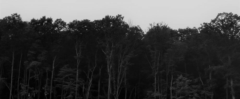
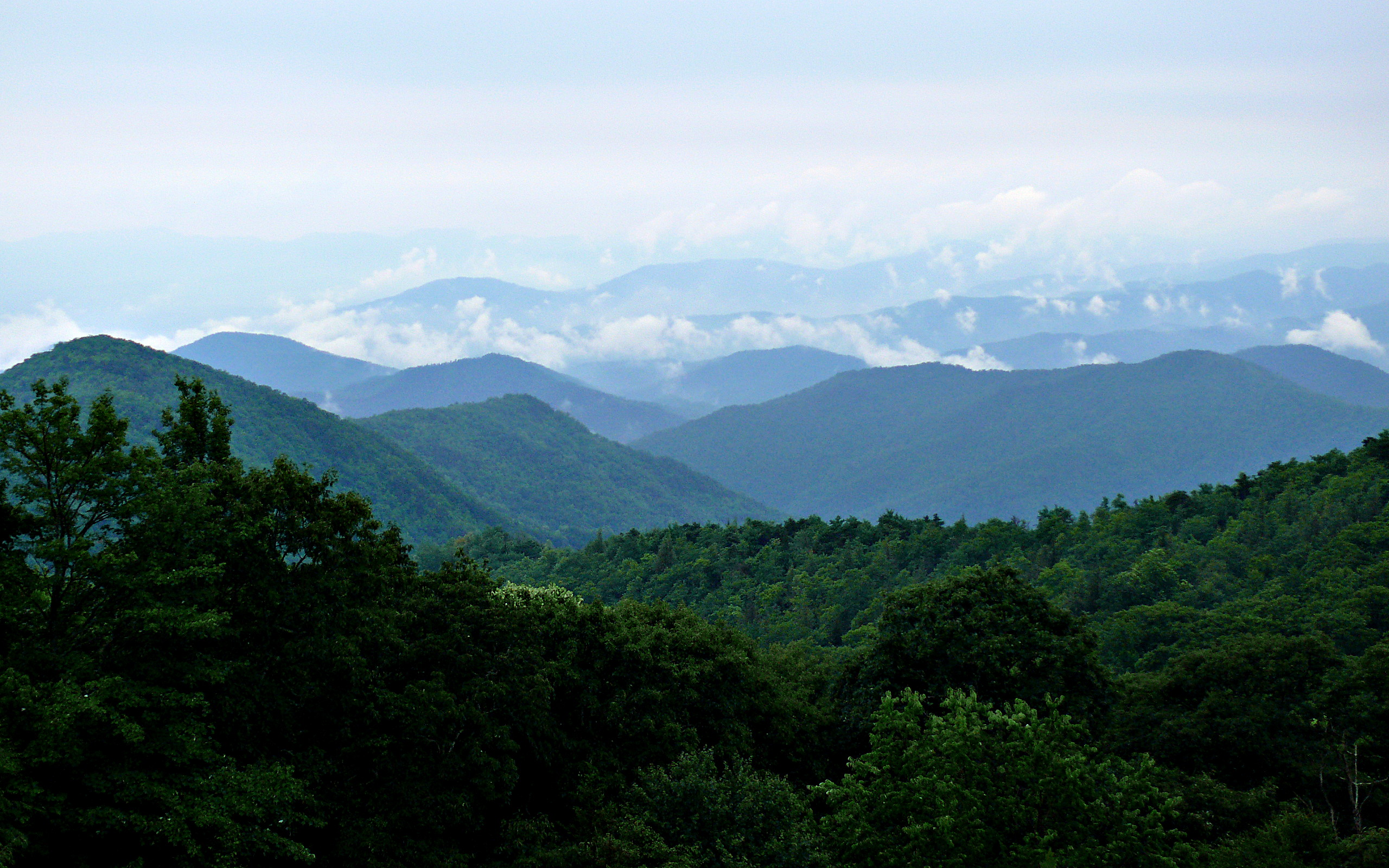
I took these photos from the highest part of the Blue Ridge Parkway, in Jackson County, near Sylva. It still looked like winter up this high (around 5500 – 6,000 ft). Most of the trees are still bare, though a few are starting to bud. A little higher up, and deciduous trees give way completely to Fraser firs (a type of conifer native to the Southern Appalachians that grows on the highest slopes).
The microclimate at these heights has been compared to that of states much farther north, and even southern Canada. It never gets very hot here, even in the summer, and it gets a lot more snowfall than we do in the valleys and lower elevations. I don’t think anyone actually lives this high up, though.
One thing I like to do to pass the time and relax is take “virtual” roadtrips. Virtual roadtrips are all over Youtube and are created by people who attach a dashcam to their dashboard while driving. I’ve posted some impressive drives before. It’s a great way to see the world without having to actually travel or spend any money at all, and I find it to be a lot of fun and educational too.
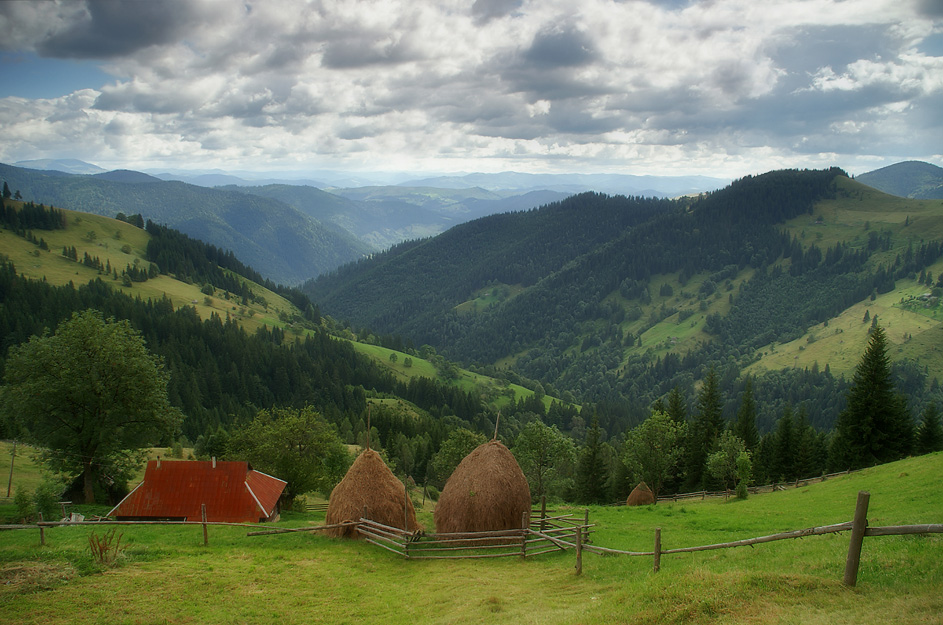
I was amazed by this drive through the mountain roads of rural Croatia because the scenery and terrain so closely resembles the southern Appalachians which run through several states in the southeast US, with the highest peaks in North Carolina, where I live.
The scenery is so similar that if you showed me this video and didn’t tell me where it was, I would swear I was back home.
Use the full screen feature in the lower right hand corner to experience the full effect.
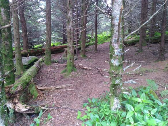
I enjoyed our day trip to Sunburst a couple of weeks ago so much that I decided to go back, only this time alone. I left my house early and arrived there at about 11 AM.
I was the only person there! How wonderful! I could easily imagine I was the only person in the world, and this tranquil and perfect little spot with its cold mountain water, breathtaking views, and swarms of colorful butterflies was my own little Garden of Eden.
This time I had taken along a couple of plastic gallon jugs, and filled both with the cold, clear water. I know it’s perfectly safe to drink as is without filtering it, because I tried it last time we went and didn’t get sick.
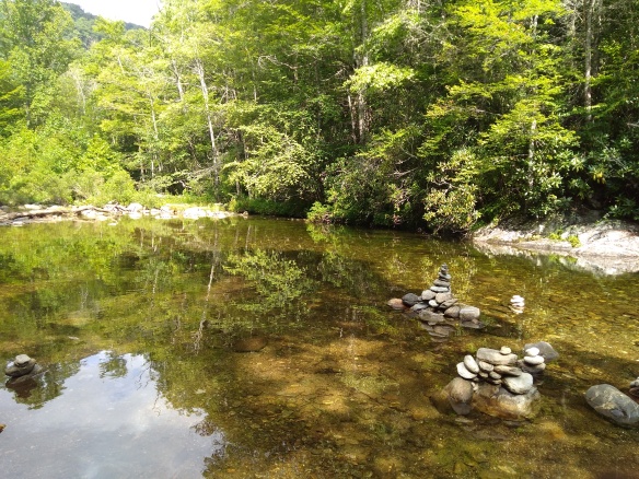
With no other people splashing the water, it was very still, and therefore it was easier this time to get an idea of how deep the water may have been in the “swimming hole” area. The slope down into it was quite steep from where I stood at waist level. My guess was the water in the deepest spot was about 6 or 7 feet. You could still see the stones at the bottom, with the water at that depth taking on a greenish tint.
Looking down into the “swimming hole.”
Here and there in the shallows were little piles of different sized stones.
I’m not sure if these are some kind of markers, or if they’re just there for decoration. Whatever they were there for, I thought they made for interesting photographs.
If anything, there were even more butterflies here this time than last. I spent less time taking pictures of them, but I did take this one because it includes a yellow and black butterfly that doesn’t quite fit in with the rest (there were actually quite a few of them there too).
I stayed about an hour and waded out into the water up to my waist, then decided to go home because I had errands to run. On the way up the hill back to my car, I saw some trash. That made me angry. Why are people such pigs? Why would they desecrate this idyllic Eden-like spot with their garbage?
I looked in the car and found a trash bag in the back, and spent about 10 minutes picking up beer cans, chip bags, styrofoam cups, etc. Then I got in the car and drove back home. I think I’ve found my happy place. I’ll keep coming back here often. It should be lovely in the fall.
I had to get out of the house yesterday and clear my head. I’ve been very upset about the situation with the children at the border.
Nature usually calms my soul and centers me, so in spite of the iffy, partly cloudy weather, I took a drive to Mount Mitchell State Park, about 50 miles to the north from where I live. Mount Mitchell is part of the Black Mountains (eastern flank of the Blue Ridge) and at 6,683 ft is the highest mountain on the East Coast (Mount Washington in New Hampshire is the second highest, at 6,289 ft).
It was noticeably cooler at the summit, almost sweater weather. That high up, only conifer trees can grow, and the area is known for its Frasier firs, a species known only to this area that almost died out about twenty years ago due to an aphid infestation. There are still many white skeleton-looking trunks of the trees that died off, mixed with the newer trees, giving the area an eerie but interesting look.
Down here in the southern Appalachians, the trees still have some color (a few are even still mostly green!) I’m also happy to say that once October came, the trees seemed to be more colorful than they have been in the past several years. Perhaps this was due to the very rainy July and August, followed by a very dry September. It’s also been unseasonably warm (though not hot). So I actually found myself appreciating Fall more this year.
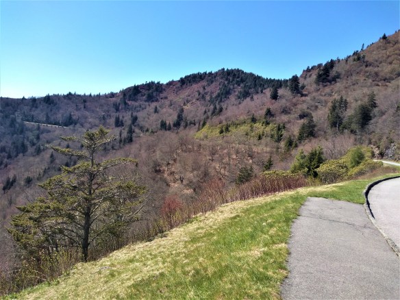
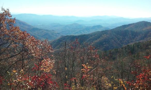
This is my second drive along the Blue Ridge Parkway since fall started, and I’m happy to say the weather this time was much more pleasant than the last time. This time I decided to drive north on the Parkway (last time we drove south, to Mount Pisgah), with the intention of making it to the Virginia border.
But I got a very late start (it was almost 1:00 when I started out) and drove as far as I could to leave myself enough time to drive back before it got too dark. I made it as far as the Blowing Rock/Boone area , which is about 120 miles north from where I live.
The parkway begins to climb when you enter the Black Mountains, on its way to Mount Mitchell, the highest peak on the East Coast. I chewed gum to relieve the popping in my ears. As you climb, the trees become shorter and scrubbier, almost like shrubs. At that high an elevation, that’s as high as deciduous trees can grow. Their short and slightly twisted stature helps them conserve energy and protects them from the high winds. At that high elevation, the air is colder and the trees were completely winter-bare–except that many of these trees are sporting clusters of bright red berries! Craggy Gardens, several miles south of Mount Mitchell, is filled with wild evergreen rhododendrons and all those attractive red-berried small trees.
I had the radio on while I drove, and kept switching stations. I settled on a country station that was playing this song about driving on backroads so I left it on and sang along while driving.
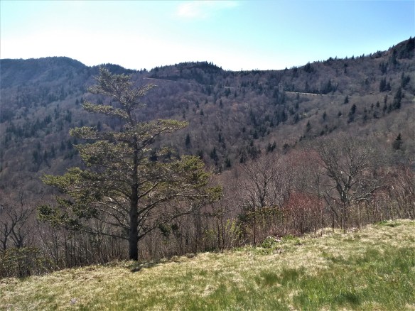
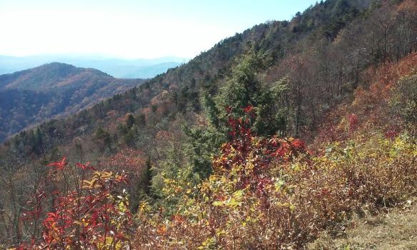
As you drive farther, you can see the rather sharp delineation (around 5,500 feet) where the conifers and fir trees (taiga zone) begin to take over from the last stunted deciduous trees. That high up, the climate is too cold for even deciduous trees to survive. At the tops of the peaks of the Black Mountain range, there are nothing but dark conifers, which gives the mountains the black appearance that inspired their name. The starkness of the landscape this time of year gives it a primordial feel and you are stuck by just how ancient these mountains are (they are the oldest mountain range in the world: millions of years ago, they were as high as the Sierras).
Once you pass through the Blacks, the road descends and your ears start to pop again. For about 30 miles the landscape is pretty, but not that exciting. There are a few spectacular views from the various outlooks, where people stop to take pictures or take a break from driving. The deciduous trees took over again, but this far north, I noticed they were almost completely bare and did not show the color the trees farther south did. I realized that even though I’d only driven about 70 or 80 miles by this point, I’d probably entered a more northerly “hardiness” zone. The landscape had a decidedly more “northern” look even though I was still in North Carolina (and would be for some time, since I live very close to the South Carolina border).
I drove about another 50 miles and passed through another mountain range almost as high and impressive as the Blacks with a more rugged appearance (Linville Gorge Wilderness). Grandfather Mountain is here, just outside of Marion, and I remembered my son went on an Outward Bound expedition here as his 8th grade school trip and how much that experience seemed to change and mature him. By this point I was picking up a rock station out of Winston-Salem, so I left that on for awhile. I also found another station–an oldies station that plays only music from the 50s and 60s! (I didn’t think those existed anymore!)
I kept driving, and the landscape leveled out again. I passed through areas where you could actually see private homes and farms from off the Parkway (closer to where I live, the Parkway’s surrounded by the Pisgah National Forest, so you cannot see private homes or property from the road). It looked like winter here, even though the temperature wasn’t that cold. When I reached the Blowing Rock/Boone area, I decided it was time to turn around and go back. It was already close to 3:30 and since I have such terrible night vision and knew it would be getting dark by 6 (we set the clocks back tonight, folks) that I could go no further. My bladder was about to burst! I stopped back at Craggy Gardens to pee, but had to use their Port-a-Potty because the visitor center was closed.
I arrived home just after sunset. I love driving on the Parkway; it’s always so relaxing and spiritually uplifting, no matter what time of year I go.
An increasingly common sight in Buncombe County, NC
Actually, most of them aren’t true Russians, they are Slavic people from Eastern Europe, especially The Ukraine, which was once under Soviet rule, so that probably explains some of the confusion.
Eastern Europeans began to flood Buncombe County during the 1990s, with Asheville being at the center of the immigration activity. In the past decade or so, Slavs have become such a large chunk of the demographic here that signs in most of the downtown public buildings, such as the courthouse and the health department, are in English, Spanish, and Russian (or Ukrainian, which I think is similar to Russian and uses the same Cyrillic alphabet–I can’t tell the difference!).
Some long-time residents of this area complain about the huge influx of the “Russians,” as they do about the large Mexican population already established here. Personally I find both groups add a lot to the culture, and don’t cause any problems at all. In the case of the Ukrainians (to my understanding, the largest group of Slavs moving to Asheville and Buncombe County), they are escaping from an intolerable situation in their own country, where Ukrainians, in spite of declaring their independence from the Soviet Union in 1991, are facing religious abuse and their country is being torn apart by opposing political forces which are outside the interests of freedom. Here is an article (about a year old) from the Asheville Citizen-Times that goes into more detail about the discord going on in the Ukraine.
Sadly, this attitude is pretty common. The new immigrants aren’t even technically Russian.
Why have so many Eastern Europeans chosen the Asheville area as their destination? I’m not sure, but I think it could have something to do with the similar climate and terrain in the Southern Appalachians (the entire Appalachian range runs from Georgia through Maine) to parts of Eastern Europe (even though their climate is somewhat more continental and less humid–and has colder winters). The Southern Appalachians have been compared by many people to the Carpathians which run through the Ukraine, Romania, Slovakia, and Serbia, and one of the counties next to Buncombe County is even called Transylvania County due to it’s appearance. The 2003 movie “Cold Mountain,” a civil war epic about people living in western North Carolina during the mid 19th century and later, was actually filmed in Romania (it was cheaper to film it there, and the Carpathians are less untouched by modernity than the Smoky and Blue Ridge Mountains). I’ve seen photos of the Carpathians, and it’s almost spooky how similar they look to this part of the US!
Which one is the Blue Ridge Mountains? (Click on the photos and the picture titles will tell you which is which).
The culture of the mountain people in both areas also have similarities. There’s an organization called the Carpathian-Appalachian Conference which holds meetings and sponsors educational and other events that seek to understand the similarities and differences between the two cultures.