
Looking up toward Craggy Dome, 6105 ft.
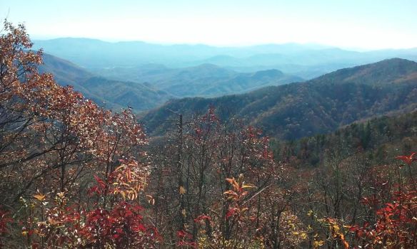
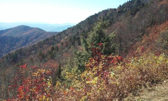
Down here in the southern Appalachians, the trees still have some color (a few are even still mostly green!) I’m also happy to say that once October came, the trees seemed to be more colorful than they have been in the past several years. Perhaps this was due to the very rainy July and August, followed by a very dry September. It’s also been unseasonably warm (though not hot). So I actually found myself appreciating Fall more this year.
This is my second drive along the Blue Ridge Parkway since fall started, and I’m happy to say the weather this time was much more pleasant than the last time. This time I decided to drive north on the Parkway (last time we drove south, to Mount Pisgah), with the intention of making it to the Virginia border.
But I got a very late start (it was almost 1:00 when I started out) and drove as far as I could to leave myself enough time to drive back before it got too dark. I made it as far as the Blowing Rock/Boone area , which is about 120 miles north from where I live.

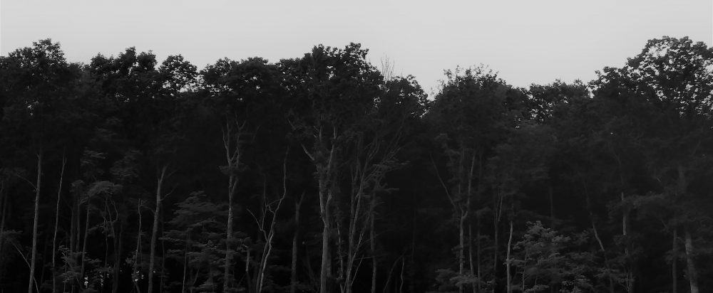
The parkway begins to climb when you enter the Black Mountains, on its way to Mount Mitchell, the highest peak on the East Coast. I chewed gum to relieve the popping in my ears. As you climb, the trees become shorter and scrubbier, almost like shrubs. At that high an elevation, that’s as high as deciduous trees can grow. Their short and slightly twisted stature helps them conserve energy and protects them from the high winds. At that high elevation, the air is colder and the trees were completely winter-bare–except that many of these trees are sporting clusters of bright red berries! Craggy Gardens, several miles south of Mount Mitchell, is filled with wild evergreen rhododendrons and all those attractive red-berried small trees.


I had the radio on while I drove, and kept switching stations. I settled on a country station that was playing this song about driving on backroads so I left it on and sang along while driving.
As you drive farther, you can see the rather sharp delineation (around 5,500 feet) where the conifers and fir trees (taiga zone) begin to take over from the last stunted deciduous trees. That high up, the climate is too cold for even deciduous trees to survive. At the tops of the peaks of the Black Mountain range, there are nothing but dark conifers, which gives the mountains the black appearance that inspired their name. The starkness of the landscape this time of year gives it a primordial feel and you are stuck by just how ancient these mountains are (they are the oldest mountain range in the world: millions of years ago, they were as high as the Sierras).

Once you pass through the Blacks, the road descends and your ears start to pop again. For about 30 miles the landscape is pretty, but not that exciting. There are a few spectacular views from the various outlooks, where people stop to take pictures or take a break from driving. The deciduous trees took over again, but this far north, I noticed they were almost completely bare and did not show the color the trees farther south did. I realized that even though I’d only driven about 70 or 80 miles by this point, I’d probably entered a more northerly “hardiness” zone. The landscape had a decidedly more “northern” look even though I was still in North Carolina (and would be for some time, since I live very close to the South Carolina border).

I drove about another 50 miles and passed through another mountain range almost as high and impressive as the Blacks with a more rugged appearance (Linville Gorge Wilderness). Grandfather Mountain is here, just outside of Marion, and I remembered my son went on an Outward Bound expedition here as his 8th grade school trip and how much that experience seemed to change and mature him. By this point I was picking up a rock station out of Winston-Salem, so I left that on for awhile. I also found another station–an oldies station that plays only music from the 50s and 60s! (I didn’t think those existed anymore!)
I kept driving, and the landscape leveled out again. I passed through areas where you could actually see private homes and farms from off the Parkway (closer to where I live, the Parkway’s surrounded by the Pisgah National Forest, so you cannot see private homes or property from the road). It looked like winter here, even though the temperature wasn’t that cold. When I reached the Blowing Rock/Boone area, I decided it was time to turn around and go back. It was already close to 3:30 and since I have such terrible night vision and knew it would be getting dark by 6 (we set the clocks back tonight, folks) that I could go no further. My bladder was about to burst! I stopped back at Craggy Gardens to pee, but had to use their Port-a-Potty because the visitor center was closed.
I arrived home just after sunset. I love driving on the Parkway; it’s always so relaxing and spiritually uplifting, no matter what time of year I go.

I enjoyed this post very much. Very interesting, beautiful photos! Thank you.
LikeLiked by 1 person
Glad you liked it. 🙂
LikeLike